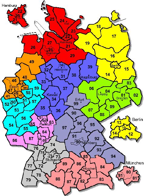
Idea: Mapping: German postcode zones (1-dig, 2-dig) available?
-
Hi all - on the map it would be great, if the postcode zones were visible. As such a layer currently seems not be available, I'd like to add a pic in the background, showing the current map semi-transparent, jpg + map grouped for zoom.
-> any idea?
Caution: attached postzone map might not be free, it's googled...Attachments
PLZ_karte.jpg 99K -
4 Comments
-
There is a sample version of this available for the UK...turn on experimental features and look at:
Map View: View Toolbar: Map: Other online Maps > UKpostcodes
This was not done by us - we found it, and configured it as a tiled map in Omniscope.
We can do the same for most Open Street Map derivations if you can find all the data you need. -
Closing the post - this is implemented and here are the instructions...
http://forums.visokio.com/discussion/comment/9254/#Comment_9254
This discussion has been closed.
← All Discussions Welcome!
It looks like you're new here. If you want to get involved, click one of these buttons!
Categories
- All Discussions2,595
- General680
- Blog126
- Support1,177
- Ideas527
- Demos11
- Power tips72
- 3.0 preview2
Tagged
To send files privately to Visokio email support@visokio.com the files together with a brief description of the problem.


