
GIS: Geocoding (ESRI)
-
Omniscope's DataManager supports geocoding of geographical place names into WGS84 latitude/longitude coordinates. Currently you have a choice of geocoding via 3 services:
- Esri (batch) - Returns the highest ranking match per location. More efficient for large datasets than using Esri multi-match.
- Esri (multi-match) - Can return multiple matches per specific place name, e.g. a place called "Aberdeen" exists in Scotland, Hong Kong etc.
- Yahoo - Yahoo BOSS PlaceFinder.
Each of these services requires an account with the relevant service provider. Links to the provider's sign-up page are included in the Geocode block.
INSTRUCTIONS- Create a new file in Omniscope and go to DataManager.
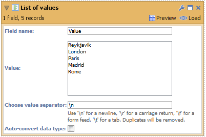
- Add a 'List of values' block to the DataManager workspace and insert some values (to test the feature) or use a dataset that already has a location field.
- Connect a Geocode block to your workflow, select the field "Values" (containing your place names) and choose a geocoding service:
- Esri (batch)
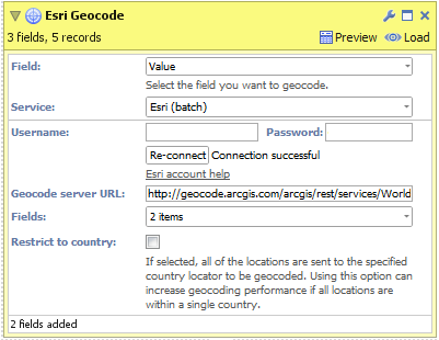
- After signing up for an account, enter your username and password then click 'Connect'.
- Select the fields you want the geocoding service to return.
- Click "Restrict to country" if all of your place names exist within a single country. This can improve the accuracy of geocoded results.
- Click "Execute" to begin geocoding.
NB: "Geocode Service URL" is an advanced option for overriding which Esri geocoding service Omniscope will use to generate results. - Esri (multi-match)

- After signing up for an account, enter your username and password then click 'Connect'.
- Select the fields you want the geocoding service to return.
- Click "Restrict to country" if all of your place names exist within a single country. This can improve the accuracy of geocoded results.
- Configure "Max matches" to select how many results you would like returned for each input place name.
- Click "Execute" to begin geocoding.
NB: "Geocode service URL" is an advanced option for overriding which Esri geocoding service Omniscope will use to generate results. - Yahoo
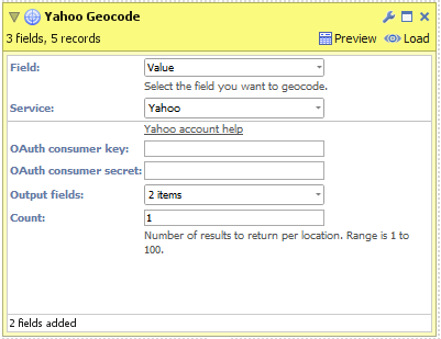
- After signing up for an account, enter your OAuth consumer key and secret then click 'Connect'.
- Select the fields you want the geocoding service to return.
- Configure "Count" to select how many results you would like returned for each input place name.
- Click "Execute" to begin geocoding.
- Esri (batch)
- Load the data into Omniscope to see the geocoded place names and visualise the data in the Map View.

Attachments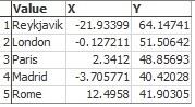
geocoded place names.jpg 13K 
place names.png 9K 
Yahoo.png 14K 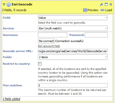
Esri multi match.png 22K 
Esri batch.png 19K

Welcome!
It looks like you're new here. If you want to get involved, click one of these buttons!
Categories
- All Discussions2,595
- General680
- Blog126
- Support1,177
- Ideas527
- Demos11
- Power tips72
- 3.0 preview2
Tagged
- mapping30
- location_analytics15
- geo-coding10
- ESRI9
- gis4
- esri1
To send files privately to Visokio email support@visokio.com the files together with a brief description of the problem.