
GIS: Importing an ESRI Shapefile
-
Omniscope's DataManager supports importing geographical data from ESRI Shapefiles. Use the attached files and following steps for a basic example;
ATTACHED FILES- "postcode areas.shp" (inside ZIP) Contains geometries for each feature (shape) in the Esri Shapefile
- "postcode areas.dbf" (inside ZIP) Contains meta-data for each feature (shape) in the Esri Shapefile
- "postcode areas.prj" (inside ZIP) Contains the coordinates' projection, e.g. UTM, WGS84.
INSTRUCTIONS- Download the attached ".zip" file and extract the ".shp", ".dbf" and ".prj" files into the same folder.
- Create a new file in Omniscope and go to DataManager.
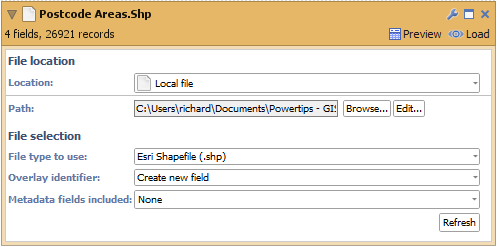
- Drag the "postcode areas.shp" file onto the DataManager workspace (or drag a "Data file" block onto the workspace and browse to the "postcode areas.shp" file). The ".dbf" and ".prj" files will be automatically detected.
- The Esri Shapefile DataManager block contains 2 configurable options
- "Overlay identifier" - The field which contains unique identifiers for each feature (shape) in the file. In our Shapefile this would be the names of the postal areas, e.g. AB for Aberdeen, SW6 for South West London. If your data does not include such a field then selecting "Create new field" will allow Omniscope to generate internal unique identifiers using a field named "Overlay ID".
- "Meta data fields included" - The names of all fields which will be loaded from the Esri Shapefile into the block.
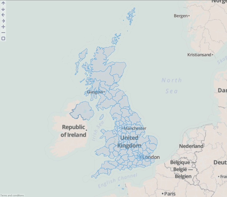
- Load the data into Omniscope then drag a Map View into Omniscope to see the postcode areas.
ADVANCED
You will notice a field has also been created named "Overlay sub-path ID". This is used internally within Omniscope to identify nested geometries within each shape. For example a shape for the United Kingdom could not be drawn with one continuous line. We use this field to breakdown the records into numerous islands which make up the country.Attachments
DataManager Block.png 10K 
Map View.jpg 468K 
postcode areas.zip 293K

Welcome!
It looks like you're new here. If you want to get involved, click one of these buttons!
Categories
- All Discussions2,595
- General680
- Blog126
- Support1,177
- Ideas527
- Demos11
- Power tips72
- 3.0 preview2
Tagged
To send files privately to Visokio email support@visokio.com the files together with a brief description of the problem.