Mapping: Using Google Maps with Omniscope?
-
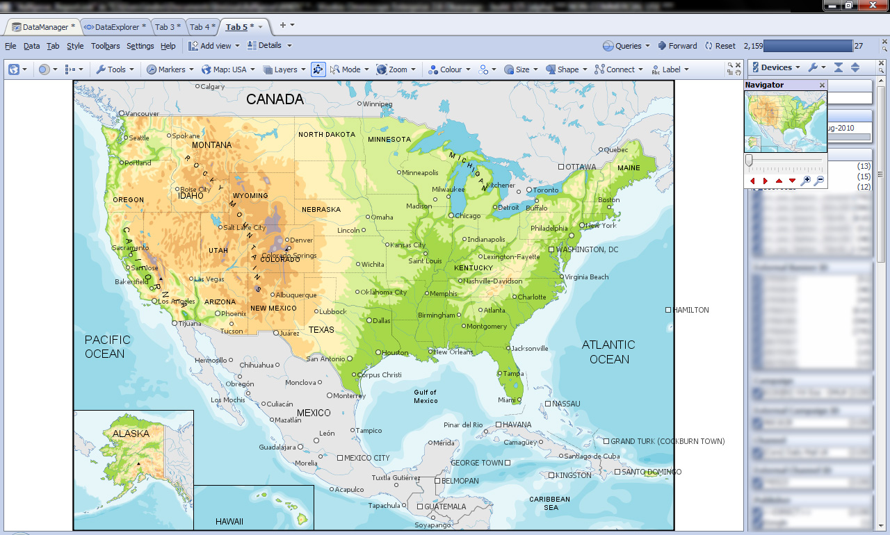
Hi - I am currently working on the Map View in Omniscope, and I want to use the Google Map view. The user guide says that there is an option to switch between vector maps and Google maps in the toolbar, but I cannot find that. Could you please help? The screenshot is attached below. Cheers Indranil.Attachments

Google-Maps-Query.jpg 383K Indranil Datta
Invizua Limited - www.invizua.com - Dedicated to Media, Marketing Services and Market Research Organisations
M: +44 7956 470 046 | E: indranil.datta@invizua.com | Skype: indranildatta1 | LinkedIn: www.linkedin.com/in/indranildatta | Twitter: @indranildatta
Address: Studio 6, 36-42 New Inn Yard, London EC2A 3EY -
7 Comments
-
Indranil - Google Maps is no longer used from version 2.6 onwards. From 2.6 the whole mapping has been greatly improved with new online maps, more information on this can be found on http://www.visokio.com/okavango
You can access the new online maps from the Maps button in the toolbar of the Map view. -
Hi Mustafa,
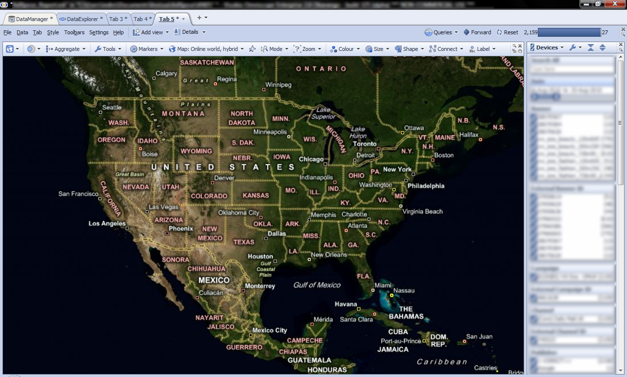
Thanks for your comments. I have tried out the online, hybrid map that seemed to be the closest to google maps. Please let me know if there are other option available. A couple of issues though. I am getting slightly blurry labels for the city and state names(see attached screenshot). Is it possible to get crisper labels and configure label colors etc? Also, the slider bar in the zoom menu does not zoom to the city levels. I can, however, get down to street levels using the "Zoom to fixed region" option. Is there a way to configure the sliders to zoom to the street levels?
Cheers!
Indranil.Attachments
Google-Maps-Query2.jpg 574K Indranil Datta
Invizua Limited - www.invizua.com - Dedicated to Media, Marketing Services and Market Research Organisations
M: +44 7956 470 046 | E: indranil.datta@invizua.com | Skype: indranildatta1 | LinkedIn: www.linkedin.com/in/indranildatta | Twitter: @indranildatta
Address: Studio 6, 36-42 New Inn Yard, London EC2A 3EY -
Indranil,
You will find you can also zoom in more precisely by dragging anywhere on the map with the right mouse button when in Zoom mode. This will allow you to zoom into the street level more easily. We'll see if the slider can be improved - thanks for reporting this.
Since these maps are tiles of images at a sequence of resolutions, when you are in-between two resolutions, Omniscope scales the images, resulting in blurry titles in some cases. The titles are part of the image tiles themselves. You don't get this with map websites because they limit you to zooming in precisely to one of around 16 steps, whereas Omniscope allows you to zoom in precisely to whatever region you want.
You will find if you zoom out slowly you can find a zoom level where the images are closer to their original size and are much crisper.
Alternatively, switch to Online world, satellite. Choose Tools > Show dynamic place labels, and Tools > Place labelling options > Background > Enabled. You won't see the state names, but will see towns and cities. -
thanks very much SteveIndranil Datta
Invizua Limited - www.invizua.com - Dedicated to Media, Marketing Services and Market Research Organisations
M: +44 7956 470 046 | E: indranil.datta@invizua.com | Skype: indranildatta1 | LinkedIn: www.linkedin.com/in/indranildatta | Twitter: @indranildatta
Address: Studio 6, 36-42 New Inn Yard, London EC2A 3EY -
Any chance of Ctrl+scrollwheel (and/or Ctrl+/-) zooming in the Map view when not in Zoom mode? Would be great to have 'standard' Windows functionalityAtheon Analytics Ltd
w: www.atheonanalytics.com
e: guy.cuthbert@atheon.co.uk
t: +44 8444 145501
m: +44 7973 550528
s: guycuthbert
This discussion has been closed.
← All Discussions Welcome!
It looks like you're new here. If you want to get involved, click one of these buttons!
Categories
- All Discussions2,595
- General680
- Blog126
- Support1,177
- Ideas527
- Demos11
- Power tips72
- 3.0 preview2
To send files privately to Visokio email support@visokio.com the files together with a brief description of the problem.


