
GIS: iGeolise routing operation
-
Omniscope's DataManager supports generating routes between pairs of points using a service provided by iGeolise. For example, this could be used to generate customer delivery routes from a distribution centre.
The following example assumes that you already have an iGeolise Travel Time account. You can sign up for an account by clicking on "iGeolise account help" in the DataManager block noted below and following the link.
ATTACHMENTS- Customer deliveries.csv - A CSV file containing the deliveries to be made from a company's distribution centre to various customers across London.
INSTRUCTIONS- Create a new file in Omniscope and go to DataManager.
- Drag "Customer deliveries.csv" onto the DataManager workspace.
- Create a new "iGeolise Travel Time" operation and connect it to your workflow. This block will use the point data from the CSV and generate routes from the distribution centre to each customer location.
- Enter your iGeolise Travel Time application ID and key.
- Choose the "Routing" service.
- Change the "Transport type" to "Driving" so the service will calculate results based routes which the company's delivery vans can travel on.
- Enter a maximum journey duration, e.g. 60 minutes. Any destinations which cannot be reached in that time will be filtered out.
- Go to the 'Fields' tab to configure. We need to configure which fields this block should use to identify the origin and destination of each route:
- Point identifier - Field containing unique identifiers for each point in the input dataset. In our example this would be the names of the distribution centres or customers.
- Longitude - Field containing WGS84 longitude values.
- Latitude - Field containing WGS84 latitude values.
- Execute the block, load the data into Omniscope and then drag a Map View into Omniscope to see the routes.


Attachments
Customer deliveries.csv 414B 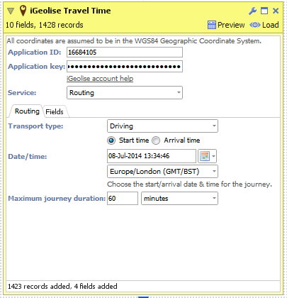
DataManager Block 1.png 18K 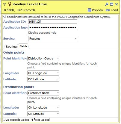
DataManager Block 2.png 22K 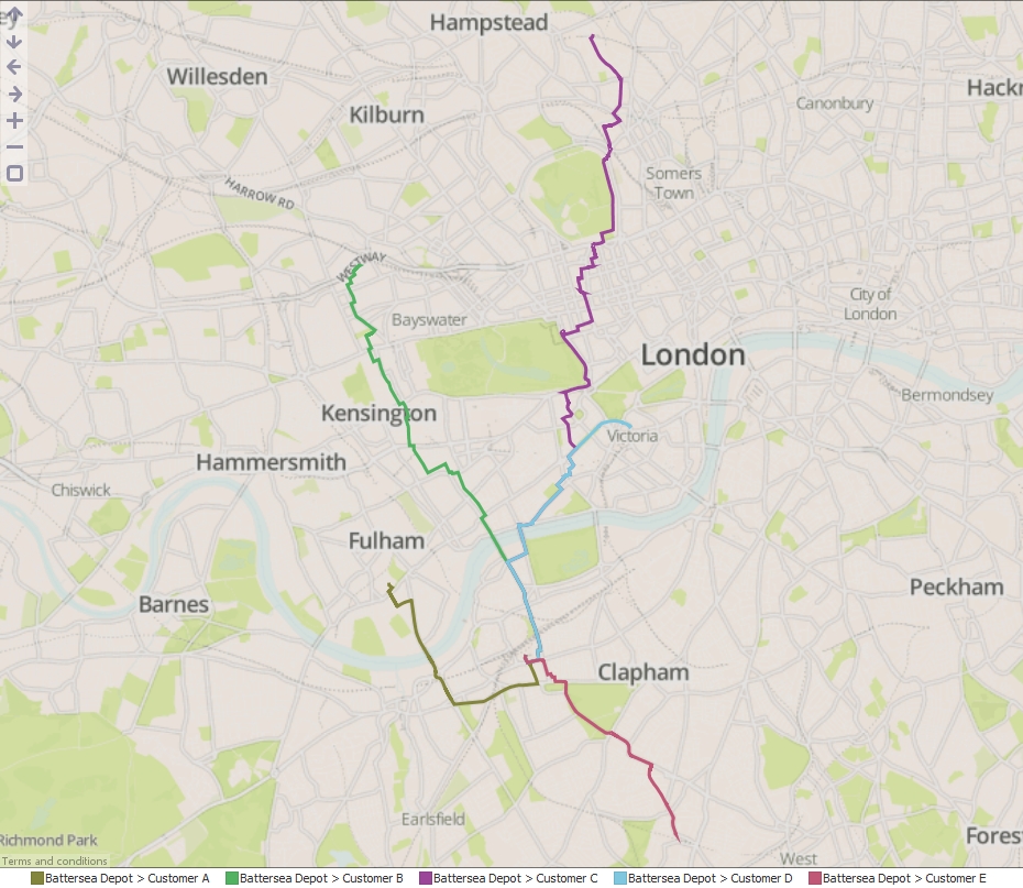
Map View.jpg 975K

Welcome!
It looks like you're new here. If you want to get involved, click one of these buttons!
Categories
- All Discussions2,595
- General680
- Blog126
- Support1,177
- Ideas527
- Demos11
- Power tips72
- 3.0 preview2
Tagged
To send files privately to Visokio email support@visokio.com the files together with a brief description of the problem.