Formulae: Linear or Euclidean distance between two geographic points?
-
Hi,
I need your support... I would like to know if it is possible to calculate with Omniscope the Euclidean distance.
I will try to explain myself better exposing the client specification request:
“Analysis of the coverage of the service on the territory: through a spatial representation directly on the map should be possible to analyze how the assisted away (distance Euclidean) from the shelters according to their concentration in a geographic area.”
Thanks, Simona
-
2 Comments
-
Here are a couple of examples of doing Euclidean distance using the LAT_LON_DISTANCE function:
http://forums.visokio.com/discussion/comment/7523/#Comment_7523
http://forums.visokio.com/discussion/comment/4675/#Comment_4675
The generally work by referring to a point and doing the calculation over a series of points shown in the data manager flows.
However from your specification it sounds a bit like you want to draw the regions themselves as shapes/areas? If that's the case you may need to use R or ArcGIS to create shapefiles which can then be loaded into Omniscope.
There's also now a iGeolise travel time connector that will draw travel time shapes which would be area based. -
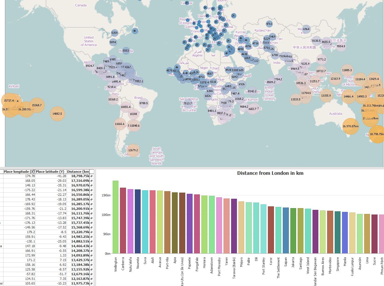
Here is a simple demo file illustrating the function, calculating distance between London and capital cities around the world.
Destination Lon/Lat field values in this formula can be replaced with another set of coordinates to calculate new set of distances from a fixed location.
LAT_LON_DISTANCE([Place latitude (Y)],[Place longitude (X)], [Destination Latitude], [Destination Longitude]) Attachments
DistanceFromLondon.JPG 190K 
Distancefrom_London.iok 835K
Welcome!
It looks like you're new here. If you want to get involved, click one of these buttons!
Categories
- All Discussions2,595
- General680
- Blog126
- Support1,177
- Ideas527
- Demos11
- Power tips72
- 3.0 preview2
Tagged
To send files privately to Visokio email support@visokio.com the files together with a brief description of the problem.


