Mapping: OpenStreetMap XML data import/export?
-
I wanted to ask if Visokio or any of the users here have been able to load in OpenStreetMap XML data into Omniscope to visualise the shapes of buildings?
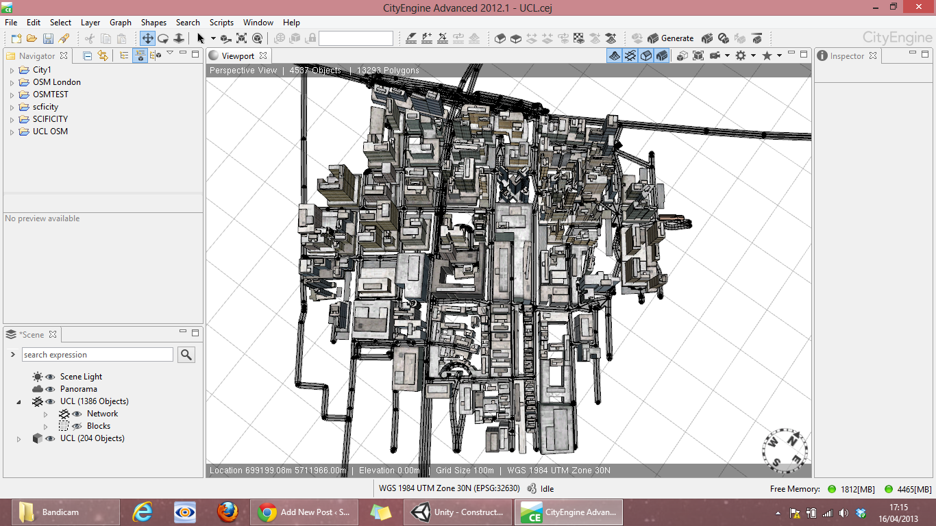
I've tried using the XML mapping input block and also to manually split up the data into Omniscope but I seem to be missing the objects and block types you would get if you put them into say CityEngine (see image). It is therefore difficult to group up all the various lines of data into the right subgroups.
Obviously this exercise is much more GIS orientated but in the example attached I am accessing the lat/long values so they can be mapped as points, I'm just having problems with the data structure in grouping and the tags.
Any help will be appreciatedAttachments
OSM UCL.iok 100K 
OSM Models.png 618K -
3 Comments
-
-
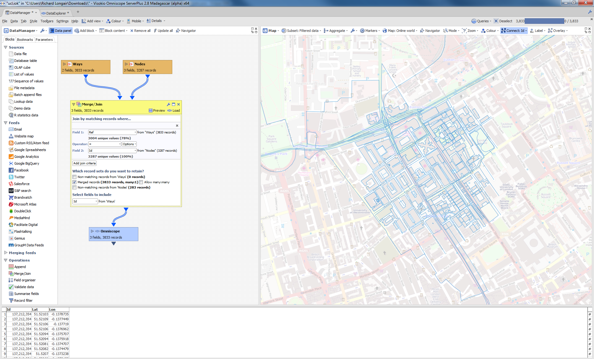
Daniel - I have uploaded an IOK which gives you the basic geometry for your file. This supports 'Ways' (lines) in OSM files.
I haven't managed to get the metadata loaded yet.
The basic approach is:
1. Load the 'Node' data in one block and read the node ID, lat, lon.
2. Load the Way's 'ND' data in another block and read in the way ID and node ref.
3. Merge the 2 block's on 'way ID' and 'node ID'
Richard -
That did the trick nicely, Thanks! I was able to then pull in the tag fields k and v and use the de-tokenise block to distribute out all the tags, and set tokenisation within Omniscope to create category fields.Attachments

ucltags.iok 88K
This discussion has been closed.
← All Discussions Welcome!
It looks like you're new here. If you want to get involved, click one of these buttons!
Categories
- All Discussions2,595
- General680
- Blog126
- Support1,177
- Ideas527
- Demos11
- Power tips72
- 3.0 preview2
Tagged
To send files privately to Visokio email support@visokio.com the files together with a brief description of the problem.


